Trail number
Not applicable
Trail length
30 kilometres (estimated)
Elevation variance
120 metres
Trail type
Single trail with interconnecting gravel roads
Trail surface
Smooth dirt, rocks and rock outcrops with lots of pine needle coverage
Weather affected
All weather
Trail condition sources
Nil
Trail features
Typically natural features are used such as trees, rocks, ledges and drop offs
Trail obstacles
Most obstacles are based around rock features and ledges. Some short sharp pinch climbs are in there as well. Getting lost is remarkably easy as pine needles cover the trails in some areas. A map or GPS with trails shown on the map files are worthwhile if you don't know the area.

Trail rating
Intermediate
Rating basis
Estimated
Night riding
Yes - but would be hard to follow tracks unless you knew the course well.
Family Friendly
No.

Refer Trail Notes Re Strava Maps
The Pines Trail at Castlemaine is located, not surprisingly, in a large pine plantation a few kilometres to the north east of town.
When you are driving up Colles Road keep an eye out for the shotgun range on the west side of the road. You can't miss it - it's the one with "Danger - Shotgun Range" signs every ten metres along the fence line. Opposite the gate to the gun range shown in the first photo, turn into the plantation Emergency Meeting Point which is shown in the second photo and park.
To access the trails, there is a trail in front of the car in the third photo - follow this for 50 metres and you will see the trails off to the left and right adjacent to the dam.
The trails are through pine forest which has a fairly rocky base with plenty of step ups, drops, etc to play around on. The trails meander through the forest and, if not ridden recently by others can be a bit hard to follow if you are unfamiliar with them. This is because the pine needles form a carpet which makes everything tend to blend.
Note: The map above is old and changes regularly due to harvesting and trimming operations in the pine plantation. It is suggested that you log onto Strava, go to Segment Explore and pick up a recent ride and download the gpx file to follow unless you have a local that can show you around.
 |
 |
 |
|---|---|---|
Park opposite the gun range. |
||
 |
 |
 |
|---|---|---|
Follow the track in the left photo into the dam area and pick up the single trail. |
||
 |
 |
 |
|---|---|---|
Fast flowing trails and rocky outcrops in photos above and below. |
||
 |
 |
 |
|---|
 |
 |
 |
|---|---|---|
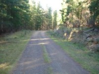
Typical logging management road on right and trail skirting another dam below. |
||
 |
|---|
Refer to the MTB Channel for further Victorian trail videos.
 |
Parking is available at Colles Road. |
|---|---|
 |
No toilet facilities are available. |
 |
No drinking water is available. |
 |
No food or drinks are available in the immediate area. |
 |
No local information facilities are available. |